ERETZ images

Collections | Contact | Chat (new)
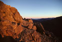
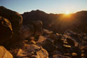
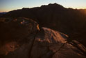
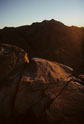
Sinai

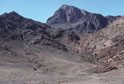
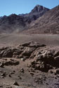
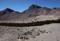
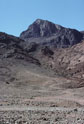
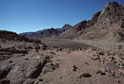
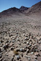
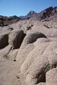
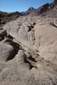
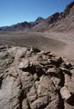
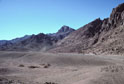
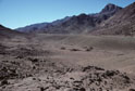
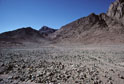
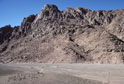
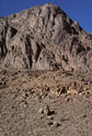
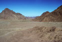
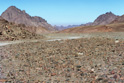
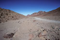
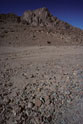
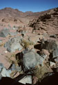
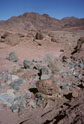
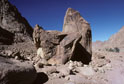
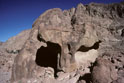
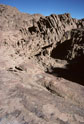
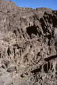
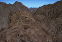
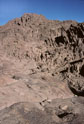
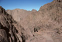
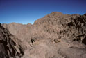
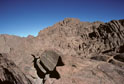
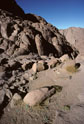
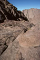
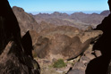
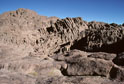
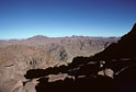
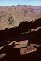
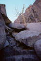
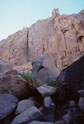
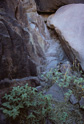
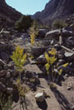
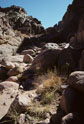
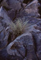
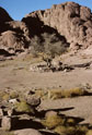
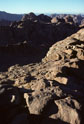
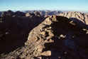
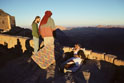
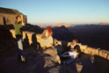
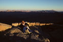
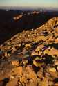
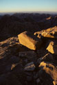
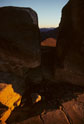
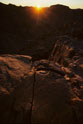
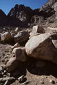
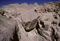
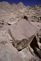
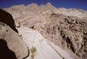
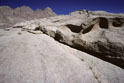
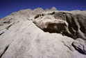
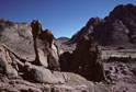
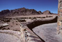
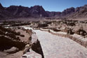
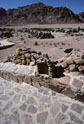
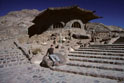
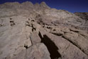
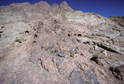
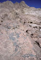
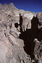
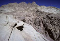
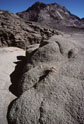
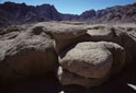
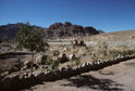
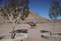
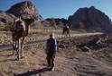
The photographs of this collection are presented today for the first time on online for Shavuot of 5768. They were taken by one geographic photographer (MW) on a few days' visit to Mount Sinai in November 2004 and include wide and closeup views of features and vistas encountered during a single ascent of the mountain.

Slideshow | Thumbnails

Mount Sinai, height 2382m, also called Mt Horeb in the scriptures, in a westward view from the junction of Wadi Sebaiyeh with Wadi es Sadad. The mountain seen here to the left of Mt Sinai is Jebel el Muneijah, height 1825m, believed by some to be the true Mt Moses, or Jebel Musa, where the Law was given.  Mount Sinai, height 2382m, also called Mt Horeb in the scriptures, in a south-westward view from Wadi es Sadad about 1 kilometer north of its junction with Wadi Sebaiyeh. The darker mountain in the left mid-ground is Jebel el Muneijah, height 1825m, believed by some to be the true Mt Moses, or Jebel Musa, where the Law was given. Mount Sinai, height 2382m, also called Mt Horeb in the scriptures, in a westward view from Wadi el Sebaiyeh whose plain here features a sparsely treed, stone-walled,  large circular enclosure. The smaller mountain to the left of Mt Sinai is Jebel el Muneijah, height 1825m, believed by some to be the true Mt Moses, or Jebel Musa, where the Law was given. Mount Sinai, height 2382m, also called Mt Horeb in the scriptures, in a westward view from the junction of Wadi Sebaiyeh with Wadi es Sadad. The closer mountain, seen arising to the left of Mt Sinai in this view, is Jebel el Muneijah, height 1825m, believed by some to be the true Mt Moses, or Jebel Musa, where the Law was given. Mount Sinai, height 2382m, also called Mt Horeb in the scriptures, seen upper mid-picture in a south-westward view from the rock-strewn plain of Wadi es Sadad about 2 kilometers north of its junction with Wadi Sebaiyeh. The closer, darker mountain to the left of Mt Sinai is Jebel el Muneijah, height 1825m, believed by some to be the true Mt Moses, or Jebel Musa, where the Law was given. Mount Sinai, height 2382m, also called Mt Horeb in the scriptures, seen upper mid-picture in a south-westward view from the rock-strewn plain of Wadi es Sadad about 2 kilometers north of its junction with Wadi Sebaiyeh. The mountain seen here to the left of Mt Sinai is Jebel el Muneijah, height 1825m, believed by some to be the true Mt Moses, or Jebel Musa, where the Law was given. Mount Sinai, height 2382m, also called Mt Horeb in the scriptures, seen upper mid-picture in a south-westward view from the plain of Wadi es Sadad, about 2 kilometers north of its junction with Wadi Sebaiyeh, where one finds remarkably sculptural sandstone formations such those seen in the foreground here. The closer, darker mountain seen here to the left of Mt Sinai is Jebel el Muneijah, height 1825m, believed by some to be the true Mt Moses, or Jebel Musa, where the Law was given. Mount Sinai, height 2382m, also called Mt Horeb in the scriptures, seen upper mid-picture in a south-westward view from the plain of Wadi es Sadad, about 2 kilometers north of its junction with Wadi Sebaiyeh, where one finds remarkably sculptural sandstone formations such those seen in the foreground here. The closer, darker mountain seen here to the left of Mt Sinai is Jebel el Muneijah, height 1825m, believed by some to be the true Mt Moses, or Jebel Musa, where the Law was given. Mount Sinai, height 2382m, also called Mt Horeb in the scriptures, seen upper mid-picture in a south-westward view from the plain of Wadi es Sadad about 2 kilometers north of its junction with Wadi Sebaiyeh. The closer, darker mountain seen here to the left of Mt Sinai is Jebel el Muneijah, height 1825m, believed by some to be the true Mt Moses, or Jebel Musa, where the Law was given. Mount Sinai, height 2382m, also called Mt Horeb in the scriptures, seen upper mid-picture in this south-westward view from Wadi es Sadad about 2 kilometers north of its junction with Wadi Sebaiyeh. The closer, darker mountain see here to the left of Mt Sinai is Jebel el Muneijah, height 1825m, believed by some to be the true Mt Moses, or Jebel Musa, where the Law was given. Mount Sinai, height 2382m, also called Mt Horeb in the scriptures, is seen at upper-right in this south-westward view from Wadi es Sadad 2 kilometers north of its junction with Wadi Sebaiyeh. The closer, darker mountain seen here to the left of Mt Sinai is Jebel el Muneijah, height 1825m, believed by some to be the true Mt Moses, or Jebel Musa, where the Law was given. Mount Sinai, height 2382m, also called Mt Horeb in the scriptures, is the most distant peak in this south-westward view from the rock-strewn plain of Wadi es Sadad at its junction with Wadi Sebaiyeh. The closer, darker mountain seen here to the left of Mt Sinai is Jebel el Muneijah, height 1825m, believed by some to be the true Mt Moses, or Jebel Musa, where the Law was given. Mountains on west boundary of Wadi Es Sadad close to its junction with Wadi Sebaiyeh. Mt Sinai is out-of-picture to the left (see image 12).   Mountain on west boundary of Wadi Es Sadad near its junction with Wadi Sebaiyeh. Mt Sinai is out-of-picture to the left (see image 12).   View from the lower end of Wadi es Sadad northwards towards its junction with Wadi Esh-Sheikh, the route from St Catherine's to the Gulf of Aqaba arm of the Red Sea. From here, in views in the opposite direction (see images 5, 7, 8 and 9), Mt Sinai can be seen. View from the middle section of Wadi es Sadad northwards towards its junction with Wadi Esh-Sheikh, the route from St Catherine's to the Gulf of Aqaba arm of the Red Sea. From here, in views in the opposite direction (see images 6, 10 and 11), Mt Sinai can be seen. View from the southern part of Wadi es Sadad northward towards its junction with Wadi Esh-Sheikh, the route from St Catherine's to the Gulf of Aqaba arm of the Red Sea.   From here, in a view to the west (to the left in this image) Mt Sinai can be seen (image 4).     Mountain on west boundary of Wadi Es Sadad near its junction with Wadi Sebaiyeh. Mt Sinai is out-of-picture to the left (see image 12). Eastward view down small boulder-strewn, sparsely-vegetated wadi entering Wadi Es Sadad centre-picture in distance.  Eastward view down small boulder-strewn, sparsely-vegetated wadi entering Wadi Es Sadad on right in distance. Free-standing, naturally sculpted rock pillars passed on way from St Catherine's Monastery in Wadi ed Deir (in distance on the right) to the Steps of Repentance, the most popular route for visitors climbing Mt Sinai. Free-standing, naturally sculpted rock pillars passed on way from St Catherine's Monastery in Wadi ed Deir (in distance on the left) to the Steps of Repentance, the most popular route for visitors climbing Mt Sinai. Rock formations seen before arrival at Elijah's Basin (see image 42) via the Steps of Repentance, the most popular route for visitors climbing Mt Sinai from St Catherine's Monastery in Wadi ed-Deir. Rock formations seen before arrival at Elijah's Basin (see image 42) via the Steps of Repentance, the most popular route for visitors climbing Mt Sinai from St Catherine's Monastery in Wadi ed-Deir. Rock formations seen before arrival at Elijah's Basin (see image 42) via the Steps of Repentance, the most popular route for visitors climbing Mt Sinai from St Catherine's Monastery in Wadi ed-Deir. Rock formations seen before arrival at Elijah's Basin (see image 42) via the Steps of Repentance, the most popular route for visitors climbing Mt Sinai from St Catherine's Monastery in Wadi ed-Deir. Rock formations seen before arrival at Elijah's Basin (see image 42) via the Steps of Repentance, the most popular route for visitors climbing Mt Sinai from St Catherine's Monastery in Wadi ed-Deir. Rock formations seen before arrival at Elijah's Basin (see image 42) via the Steps of Repentance, the most popular route for visitors climbing Mt Sinai from St Catherine's Monastery in Wadi ed-Deir. Rock formations seen before arrival at Elijah's Basin (see image 42) via the Steps of Repentance, the most popular route for visitors climbing Mt Sinai from St Catherine's Monastery in Wadi ed-Deir. Rock formations seen before arrival at Elijah's Basin (see image 42) via the Steps of Repentance, the most popular route for visitors climbing Mt Sinai from St Catherine's Monastery in Wadi ed-Deir. Rock formations seen before arrival at Elijah's Basin (see image 42) via the Steps of Repentance, the most popular route for visitors climbing Mt Sinai from St Catherine's Monastery in Wadi ed-Deir. View to the east back down a high-walled narrowed section, above Elijah's Basin (see image 42), of the Steps of Repentance, the most popular route for visitors climbing Mt Sinai from St Catherine's Monastery in Wadi ed-Deir. Rock formations seen before arrival at Elijah's Basin (see image 42) via the Steps of Repentance, the most popular route for visitors climbing Mt Sinai from St Catherine's Monastery in Wadi ed-Deir. View to the east, from above the level of Elijah's Basin, on the Steps of Repentance, the most popular route for visitors climbing Mt Sinai from St Catherine's Monastery in Wadi ed-Deir. The grey mountain seen centre picture and topped by a small white structure (a church dedicated to two Roman soldier Christian martyrs) is Gebel el Muneiyah which is shown in westward views, from Wadi es Sadad, by images 1 to 12.    View to the east, from above the level of Elijah's Basin, on the Steps of Repentance, the most popular route for visitors climbing Mt Sinai from St Catherine's Monastery in Wadi ed-Deir. The mountain in the left middle-gound and topped by a small white structure (a church dedicated to two Roman soldier Christian martyrs) is Gebel el Muneiyah which is shown in westward views, from Wadi es Sadad, by images 1 to 12.  Solitary tree skeleton amongst variously-shaped, piled granite slabs in a narrow wadi which crosses the first section of the Steps of Repentance, the most popular route for visitors climbing Mt Sinai from St Catherine's Monastery in Wadi ed-Deir. Solitary green plant with its aerial roots suspended in spaces between naturally-piled granite boulders in a narrow wadi which crosses the first section of the Steps of Repentance, the most popular route for visitors climbing Mt Sinai from St Catherine's Monastery in Wadi ed-Deir. Yellow-flowering plant spreading in shaded niche amongst delightfully variegated rock bordering the lower level of the Steps of Repentance, the most popular route for visitors climbing Mt Sinai from St Catherine's Monastery in Wadi ed-Deir. Walled Bedouin garden at the lower end of the narrow Wadi Srej (ash-Shrayj) which closely borders the southwest side of Mt Sinai (left of picture). Community of various small plants surviving in a narrow wadi which crosses the lower part of the Steps of Repentance, the most popular route for visitors climbing Mt Sinai from St Catherine's Monastery in Wadi ed-Deir. Solitary yellow-flowering plant growing in moisture-trap in granite niche on a sidewall of the lower level of the Steps of Repentance, the most popular route for visitors climbing Mt Sinai from St Catherine's Monastery in Wadi ed-Deir. View of the west part of Elijah's Basin, a picturesque, peaceful resting place and the largest area of flat ground met with on the way to the summit of Mt Sinai via the Steps of Repentance, the most popular route for visitors climbing Mt Sinai from St Catherine's Monastery in Wadi ed-Deir. Centre picture, with its base protected by a low stone wall, is one of only a few trees reaching this size that are to be found on the mountain. Evening view to northeast from a position some 20 metres below the summit of Mt Sinai. Evening view to northeast from a position some 20 metres below the summit of Mt Sinai. Evening view to northeast from a position some 20 metres below the summit of Mt Sinai. Eastward view from high on Camel Path on east face of Mt Sinai. Visitor and Bedouin guides in walled area, including Christian Chapel (left-picture), on summit of Mt Sinai at sunset. Visitor and Bedouin guides in walled area, including Christian Chapel (left-picture), on summit of Mt Sinai at sunset. The shadowed peak centre-picture is Gebel el Muneijah, well shown in westward views from Wadi es Sadad by images 1 to 12 of this collection. Bedouin guide resting in walled area on summit of Mt Sinai at sunset. Northward view from 20 metres below summit of Mt Sinai at sunset. Northward view from 20 metres below summit of Mt Sinai at sunset. South-westward view at sunset, through natural cleft in highly geometric granite formations standing on flat, cracked rock base on the summit of Mt Sinai. View to the south-west, at sunset, from 20 meters below the summit of Mt Sinai. Right-picture is the deeply shadowed east ridge of Mt Katerina (2635m) rising to its summit (see images 54, 55 and 56). Westward view of Mt Katerina (2635m) at sunset, from summit of Mt Sinai. Westward view of Mt Katerina (2635m) at sunset, from summit of Mt Sinai. Westward view of Mt Katerina (2635m) at sunset, from summit of Mt Sinai. Westward view of Mt Katerina (2635m) at sunset, from summit of Mt Sinai. Boulder-strewn small wadi at base of Sinai massif close by St Catherine's Monastery (wall visible right-picture). Rock formations able to be visited on a 15-minute climb within a few hundred meters walking distance north of St Catherine's Tourist Village (see images 65, 66, 67 and 68) located on Wadi Er-Raha in the region of Mt Sinai.  Rock formations able to be visited on a 15-minute climb within a few hundred meters walking distance north of St Catherine's Tourist Village (see images 65, 66, 67 and 68) located on Wadi Er-Raha in the region of Mt Sinai. Rock formations able to be visited on a 15-minute climb within a few hundred meters walking distance north of St Catherine's Tourist Village (see images 65, 66, 67 and 68) located on Wadi Er-Raha in the region of Mt Sinai. Naturally sculptured sandstone rock formations able to be visited on a 15-minute climb within a few hundred meters walking distance north of St Catherine's Tourist Village (see images 65, 66, 67 and 68) located on Wadi Er-Raha in the region of Mt Sinai. Naturally sculptured sandstone rock formations able to be visited on a 15-minute climb within a few hundred meters walking distance north of St Catherine's Tourist Village (see images 65, 66, 67 and 68) located on Wadi Er-Raha in the region of Mt Sinai. Free-standing rock formations in a view to the northeast towards Wadi esh-Sheikh, from close to St Catherine's Tourist Village (see images 65, 66, 67 and 68) located on Wadi Er-Raha in the region of Mt Sinai. St Catherine's Tourist Village, located on Wadi Er-Raha in the region of Mt Sinai, is a fine example of contemporary Egyptian architectural design. St Catherine's Tourist Village, located on Wadi Er-Raha in the region of Mt Sinai, is a fine example of contemporary Egyptian architectural design. St Catherine's Tourist Village, located on Wadi Er-Raha in the region of Mt Sinai, is a fine example of contemporary Egyptian architectural design. St Catherine's Tourist Village, located on Wadi Er-Raha in the region of Mt Sinai, is a fine example of contemporary Egyptian architectural design. Shown here is the elevated Restaurant, formerly the desert holiday home of President Anwar Sadat, on the north side of the Village. Rock formations able to be visited on a 15-minute climb within a few hundred meters walking distance north of St Catherine's Tourist Village (see images 65, 66, 67 and 68) and located on Wadi Er-Raha in the region of Mt Sinai.  Rock formations able to be visited on a 15-minute climb within a few hundred meters walking distance north of St Catherine's Tourist Village (see images 65, 66, 67 and 68) located on Wadi Er-Raha in the region of Mt Sinai. Rock formations able to be visited on a 15-minute climb within a few hundred meters walking distance north of St Catherine's Tourist Village (see images 65, 66, 67 and located on Wadi Er-Raha in the region of Mt Sinai.68)  Rock formations able to be visited on a 15-minute climb within a few hundred meters walking distance north of St Catherine's Tourist Village (see images 65, 66, 67 and 68) located on Wadi Er-Raha in the region of Mt Sinai. Rock formations able to be visited on a 15-minute climb within a few hundred meters walking distance north of St Catherine's Tourist Village (see images 65, 66, 67 and 68)  located on Wadi Er-Raha in the region of Mt Sinai. Rock formations able to be visited on a 15-minute climb within a few hundred meters walking distance north of St Catherine's Tourist Village (see images 65, 66, 67 and 68)  located on Wadi Er-Raha in the region of Mt Sinai. Naturally sculptured sandstone formations on level ground a few hundred meters from St Catherine's Tourist Village (see images 65, 66, 67 and 68) on Wadi Er-Raha in the region of Mt Sinai. Sinai (No. 76) The charming, gentle and wonderfully competent Bedouin Hakim (doctor) Jordan Hamdi, administrator and guide as well as our superb host and hands-on healer at Faraj Fox Camp, near St Katarina Tourist Village, on our November 2004 visit to Mt Sinai. For this portrait he sat in the Office chair, surrounded by maps and photographs of the area as well as from other important places including, of course, Mecca and Jerusalem.Technical data: camera, Canon F1; lens, L-series Canon 20-35mm; film, Kodachrome II; exposure, 1/8th second at f/3.5. No filter.Transparency scanned to digital file using Nikon 50 Coolpic 35mm scanner. Sinai (No. 78) Sinai (No. 79)

For believers, a direct experiencing of Mount Sinai, the place of the giving of the Law, the Jewish Torah, through Moses to the Children of Israel some 50 days after their exodus from Egypt, can call forth spiritual and emotional responses of magnitudes unequalled by any other place or structure on earth except Jerusalem's Mount Zion and Western Wall of the Second Temple.

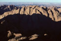
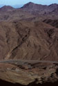
It is the historic significance of Sinai, taken together with the awe-inspiring structure of the mountain and its surrounding landscape, including the vast plain of encampment of the some 300,000 Children of Israel before the mountain, that has made countless first experiences of it transforming ones indeed.

Many visitors will have known that for the period of the giving of the Law even the ground of approach to the mountain was declared by the great I AM, the God of Abraham, Isaac and Jacob, to be holy ground, accessible to only Moses and Aaron. Some will also know Mt Sinai (Mount Horeb of the relating scripture) to have been the place of distant refuge for the prophet Elijah, and the place of God's manifesting--as to Moses, in earthquake, fire and direct speech--to Elijah for his final commissions; the anointing of Elisha as his successor, and of the next kings of Israel and Syria.

Whether the Sinai Wilderness and its famed mountain were purpose-designed to help bring the minds of its earliest Jewish refugee sojourners to the end of themselves and draw them towards following the leadings and Law of its maker is a question for individual decision. What is undeniable is that even today an experience of the Sinai and similarly inspiring landscapes often raises such searching questions, against our wills or not.